La Turista in Trinidad
 |
| Verlie and me under the Trinidad sign. |
Staying at someone's home allows for doing La Turista things that you might not ordinarily do. If I was just traveling I'd be blowing through this berg, adding up the miles, and moving on down the road, running mile after mile after mile, stopping only to gas and go.
 |
| Overlooking Trinidad. |
Trinidad is a bustling, but laid back little town, located at about a 6,500 foot elevation, with lots of beautiful old buildings and a rich history. My friends Joe and Verlie, and her Mom, have shown me places I'd have never seen.
On Saturday,
June 30, we drove up a dirt road to view the St. Aloysius church (seen the day before from the highway) that is now mostly nothing more than the front wall. The bricks, and other building materials used have mostly disintegrated with time, but it's still beautiful and we're hoping to get my bike close enough to get an awesome photo.
 |
| I walked all around the church, and really needed a photo because of the beautiful architecture. There are red bricks covered by a gray material, covered by the outside red clay-looking material. It mostly crumbled in my hands when I picked up a piece of it. But while I might explore, I'm always on the lookout for snakes. I'm scared of snakes; hate 'em. |
The church, located in Morley about 12 miles south of Trinidad, is one of the most photographed sights in Las Animas County and there are currently plans being made to stabilize and restore the structure. It was erected in 1917 for $2,300 and was the second Catholic church to be established in a CF&I (Colorado, Fuel & Iron Company) camp.
 |
| I'm not exactly a religious person, but churches are some of the most beautiful buildings in the world, in my opinion. I was particularly drawn to this one and believe that maybe I had been born in another time and era. |
There are many weed-covered foundations near the church site including a fan house. The fans in the fan house draw fresh air into the mine shaft and remove contaminated air, which was quite important since this was a coal-mining community.
 |
| This is what looked like an ice house, with a staircase leading down into it. Once again we wandered around, but I stepped carefully, looking down and around before setting my foot anywhere. Because even though I'm wearing motorcycle boots with a built up sole I'm afraid of snakes. But I was braving it out as my inner self was called to explore where I had not been before, overcoming my worrying about snakes. |
 |
| The old ruins are fascinating but the heat melts me. An old white girl from Alaska is not used to the heat and my white skin burns in no time in the near-100 degree temperature. |
The old Morley Station was later named Gallinas, Spanish for hens. This particular area had history that spans years, and there are remains where you can see there were many people who lived here, about 900 at its peak in Morley, with over 1,000 tons of coking coal produced on a daily basis.
 |
| My beautiful friend, Verlie, in one of the ruins that we thought might have been a hotel. |
 |
| Another large ruin of what we wondered if it might be a hotel. Apparently there was at least one, maybe more, hotels. Ruins are fascinating, but there's never enough time. |
 |
| This one looked like an orchard was growing in it. |
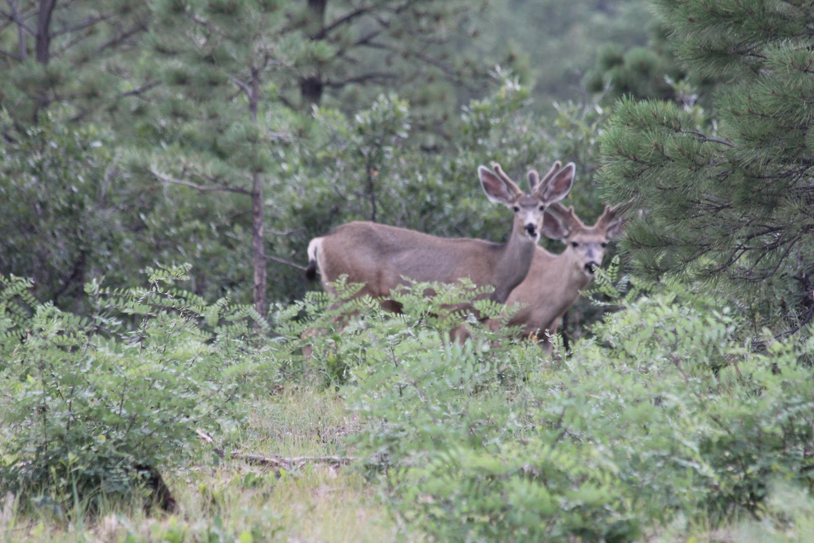
We followed the road probably 25 miles or so, and saw some spectacular homes up in the mountains and more deer. Of course, I had to try to sneak up on them so I could get the “perfect” photo. It was a group of three males, which Hobbs says is a “bachelor” group, young males bonding together until they establish their own area. It was a great time.
 |
| Two of the boys at attention. |
 |
| Look at those ears. They're longer than his antlers. |
 |
| This one's for you, Hobbs. |
I also took more photos of Fishers Peak. We were on the other side of it, so then the “car” that it looks like was reversed and going in the other direction.
 |
| Doesn't it look like a car, with the hood out front and the cab? Fisher's Peak. |
Above the town, there is a big sign for Trinidad, which lights up at night, and we drove up up Simpson's Rest to the sign. Simpson's Rest guards Trinidad, that is referred to as the gateway to the Mountain Route of the Santa Fe Trail. On Father's Day only the "DAD" is lit.
 |
| The sign with a flag. Love the flag. Can hardly wait to wear my stars and stripes shirt July 4 as I head on over to Oklahoma to meet my friend Ruth from Kansas. |
George S. Simpson, who is buried at the top of the rest, was a pioneer. He was a famous scout, trader and explorer, born in 1818 in St. Louis, Missouri. He came to the Trinidad area in 1848 and served as the region's first territorial county clerk.
 |
| Simpson's monument is quite beautiful but covered with graffiti. What's the matter with people that they have to vandalize things? |
The reason Simpson is buried on the rest is a story about a Ute Indian attack. He fled up a nearby butte and hid inside one of the crevices. After three or so days the Indians left, Simpson emerged thankful to the rock for hiding him and had a desire to be buried there. In September of 1885 the Rest became his final resting place. It's a very cool story, and just one of many of the local lore.
 |
| Verlie and Joe at the top of the hill by the sign and memorial. |
We then visited the cemetary where Verlie's dad and brother are buried. It's a beautiful cemetary, well-kept and peaceful.
 |
| Verlie's Dad and brother are buried here. |
There had been little American flags placed reverently beside the graves of those who have served and died, a reminder to all of us that “Freedom is not Free,” and we should honor those who have died for our country, and those who have served and are serving. I'm quite emphatic about this. If, as Merle Haggard sings, “If you don't love it, leave it,” I think that says it all. I love my country and my flag. God bless America!!!
 |
| There were a lot of little flags placed at gravesites, but this one struck me as special. I think it was the cavalry this person was a part of and the fact this one was quite old. And horses, both four-legged and iron are also a large part of my being and who I am today. |
 |
| And always sad are the graves of and memorials to children. |
Then all sadness flew from my mind as it was on to a wonderful dinner at Blackjack's Saloon. The salad bar was excellent and I had sweet but spicy riblets. YUM, YUM!! Yep, it all comes back to food. And all else was forgotten for now.
Another beautiful day dawned on Sunday, July 1. Woo hoo. Nothing but sunshine. Verlie's Mom wanted to go to church, so as all were going I said I would, too. It certainly can't hurt me, and it was pleasant with lots of singing. I've always liked church music, so I was happy with it.
Then it was lunch and I told them I had to ride. I'd been off the bike for a couple of days and was suffering massive withdrawal symptoms.
I followed the car and we took a very nice two-lane road with some twists and turns out to Stonewall and Monument Lake.
 |
| Yes, I know. Another deer. I love animals and taking photos of them. I can say no more about that. |
Stonewall is a little bend in the road amongst numerous ranches with large pastures and little streams. The hook here is a great wall that is narrow but visible through the entire area and beyond. The little village is located around a large gap in the Dakota Wall at the foot of the Sangre de Cristo Mountains. The wall was originally known as Stoner's Wall, named after James Stoner the first postmaster in Stonewall, and for whom the town was named. But I've been unable to find information about why or when Stoner's Wall changed to the Dakota Wall. Oh well, enough research and on to other things.
 |
| This is the wall from one side as we approached. |
The town of Stonewall is at an elevation of 8,000 feet (no wonder I cannot catch my breath) and is in a territory claimed by the Trinchera elk herd. I saw no elk, but did see a deer, a female muley. They're all so beautiful. As told, as of 2006, the humans living here were outnumbered about 100-1 by the elk. Again, can't be proved by me.
 |
| This is the wall edge where the road passes through. The wall has been cut out for the road. |
The Dakota Wall outcroppings were beautiful and of course, I had to have a photo of the bike with it. We decided to use a little ranch road and of course, gravel is not my friend. No drops, but it took a bit of time for me to get in, turned around and in position. The photo Joe took was well worth the angst of getting into position even with the heat, and the lack of air. I need an oxygen tank, I think.
 |
| Gravel and I don't get along, but I love this photo Joe took. The gravel road leads into a ranch, and of course, there was a "no trespassing" sign. Those are ignored when it comes to getting a photo. As are speed limit signs and exceptionally pink stop lights,. |
From there we headed up the road to Monument Lake. It's a beautiful spot where Verlie's Dad used to take her fishing as a girl. There was a large piece of rock in the middle of the lake, but now it's just a tiny piece sticking up. People were there fishing, and catching what looked like a nice trout. The chipmunks were out and looking for food.
 |
| Verlie, her mom and me at the lake. |
There were lots of young ones, and they kept trying to get into the fisherman's bag. Joe tossed some popcorn out but they turned up their little chipmunk noses at it. Later when we weren't paying as much attention to them they came back to get it. Joe saw one of the little ones bury a piece of popcorn so guess the little guy is planning for the future.
 |
| What ya go for us, dude? |
 |
| Even butterflies like motorcycles. This one matches my bike, black and white. It was eating bugs off the bike. It couldn't do enough eating to clean this bike. |
 |
| Joe, Verlie and her Mom. |
Then I needed a bike wash. I'd not washed Harlow since the Harley shop and she had been in great need of a wash after the monsoon. Then back to the barn for her.
 |
| Harlow getting a wash and dry. I really like the blow dryers some carwash places have. |
Off we went to eat at Rino's a nice Italian restaurant in a former church. There are singing waiters, and excellent food. Yep, it all comes back to food.
July 2 was another beautiful day and it was time to go up and take the photo at St. Aloysius ruins. Verlie, her Mom and I headed up. We got over the bridge, and then it was dirt and gravel for the 2-3 miles it took to get there. I took it slow, but there were some very sharp corners, and I took it slow and easy. I hate gravel as I've been down in it more than once, and scared out of my mind while riding on it many other times. But hey, a biker needs her photo with certain things, and I'd decided this was one of them.
I made it to the wide spot in the road, and with Verlie as my spotter, we got the bike in the exact position to catch it and the church. She took the photo I asked her to, many of course, because film is cheap and I like lots of photos so as to get the “perfect” one. I think she did it.
 |
| Is there ever a bad photo if there's a bike in it? The sun was in a good spot for us, and we got the bike turned around, no incidents. YAY!! |
Buenos noches.


No comments:
Post a Comment